The Liberia Land Authority (LLA) has stepped up efforts to improve how government institutions collect, manage, and share geospatial information needed for national planning and development following its participation in the 16th Session of the United Nations Global Geospatial Information Management meeting at the United Nations Headquarters in New York.
By Augustus D.R [email protected]
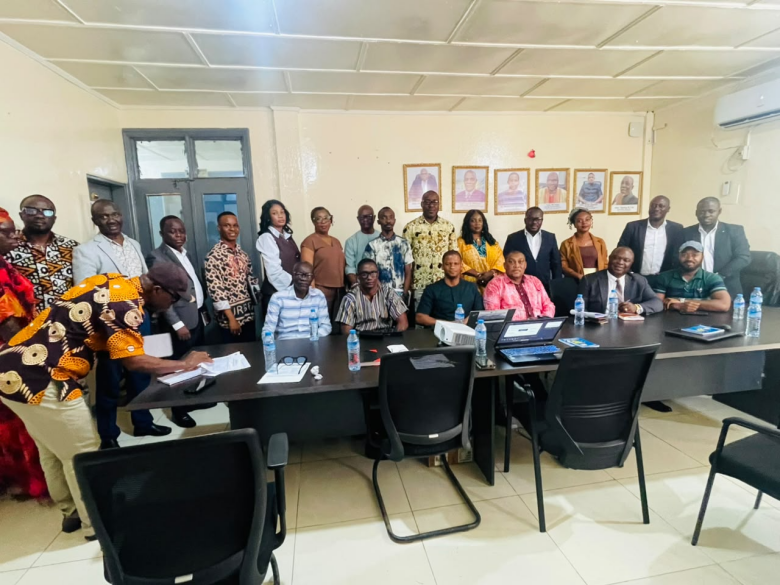
The LLA, in its quest to solidify smooth collaboration with line ministries and agencies, convened an inter-agency consultative meeting at its headquarters in Monrovia.
The meeting brought together representatives of government ministries and agencies to discuss Liberia’s engagement with the United Nations Committee of Experts on Global Geospatial Information Management, known as UN-GGIM, and the country’s participation in the Second Administrative Level Boundaries (SALB) program.
Speaking at the opening, LLA Chairman Samuel F. Kpakio called for stronger cooperation among government institutions to help establish a National Spatial Data Infrastructure for Liberia.
He said the country’s engagement at the international level had created an opportunity to strengthen its participation in global geospatial information programs, adding that government agencies must now work together to turn that opportunity into practical results.
“I am glad to see in our midst technicians who understand the subject matter. Thus, I wholeheartedly welcome you to the multi-purpose conference room of the LLA and I hope that this meeting will meet its objective,” Chairman Kpakio said.
However, during the technical discussions and presentation session of the meeting, the Commissioner for Land Administration at the LLA, Dr. Mahmoud Solomon, emphasized the importance of the SALB program in compiling and standardizing reliable information on Liberia’s administrative boundaries. He informed participants that the LLA engagement with the UN-GGIM is in alignment with the government’s ARREST Agenda for Inclusive Development (AAID).
“If we take a look at the AAID, one will understand that the AAID identified the harmonization of local boundaries, the need to improve rural and urban spatial planning, which includes development of the National Spatial Plan and the establishment of the National Cadastre as cardinal to the fulfilment of the President’s ARREST Agenda. Thus, a National Spatial Data Infrastructure would provide a common framework for government agencies to produce, update, share, and use geospatial information,” Dr. Solomon said.
According to Dr. Solomon, the development of the NSDI will help reduce duplication and enable government to make informed decisions that concern land, infrastructure, public services and national development.
He further explained that the process would help validate administrative boundaries at the level one and two, document official charges, identify institutions responsible for maintaining the data and prepare authoritative information for review before publication on Liberia’s SALB page.
He further welcomed the strong participation from government institutions, describing the turnout as an important step toward better coordination.
Liberia’s participation through the Liberia Land Authority is the first of its kind after sixteen (16) years of the UN-GGIM. The representation of the LLA provided an opportunity for Liberia to deepen collaboration with the United Nations, regional geospatial organizations and international partners in building technical capacity, mobilizing investment and adopting global best practices in geospatial information management.
Many experts believe that leveraging innovation, international cooperation, and modern geospatial technologies can accelerate sustainable development and improve the quality of life for all Liberians, as enshrined in the government’s ARREST Agenda for Inclusive Development (AAID).
The United Nations Committee of Experts on Global Geospatial Information Management (UN-GGIM) is the top intergovernmental body for global geospatial policies established by the UN Economic and Social Council (ECOSOC) in July 2011 to help member states coordinate data, build national capacities and support sustainable development goals.
The idea grew out of informal talks at the 2009 Cartographic Conference of the Americas and a formal UN Secretariat report.
It operates as an official functional commission of ECOSOC, reporting directly to member states at the highest level.
The goal is to bridge the gap in global geospatial standards, build national capacities, and support global efforts like the Sustainable Development Goals (SDGs).
However, as the Government of Liberia continues implementing reforms aimed at promoting transparency, accountability and inclusive economic growth, investments in geospatial technologies are expected to improve planning and increase efficiency in public administration, enhance land tenure security and support informed policy decisions.
Support Independent Journalism
Your support helps FrontPage Africa continue delivering independent, credible, and impactful journalism. Every contribution strengthens our ability to investigate, inform, and hold power accountable while keeping quality journalism accessible to our readers.
Support our journalism or subscribe to receive the latest FrontPage Africa stories and updates.